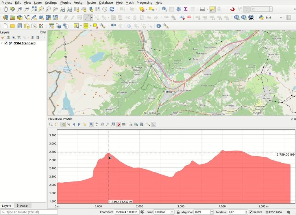
Automatic relative elevation model generation: OpenTopography’s #RiverREM is a #Python-based tool that automates the creation and visualization of relative elevation models (REMs) from digital elevation models, making it easier than ever for scientists, artists, and enthusiasts to explore the...
https://spatialists.ch/posts/2025/04-19-automatic-relative-elevation-model-generation/ #GIS #GISchat #geospatial #SwissGIS

Spatialists – geospatial newsAutomatic relative elevation model generation – Spatialists – geospatial news
More from  Spatialists


 Join our newsletter


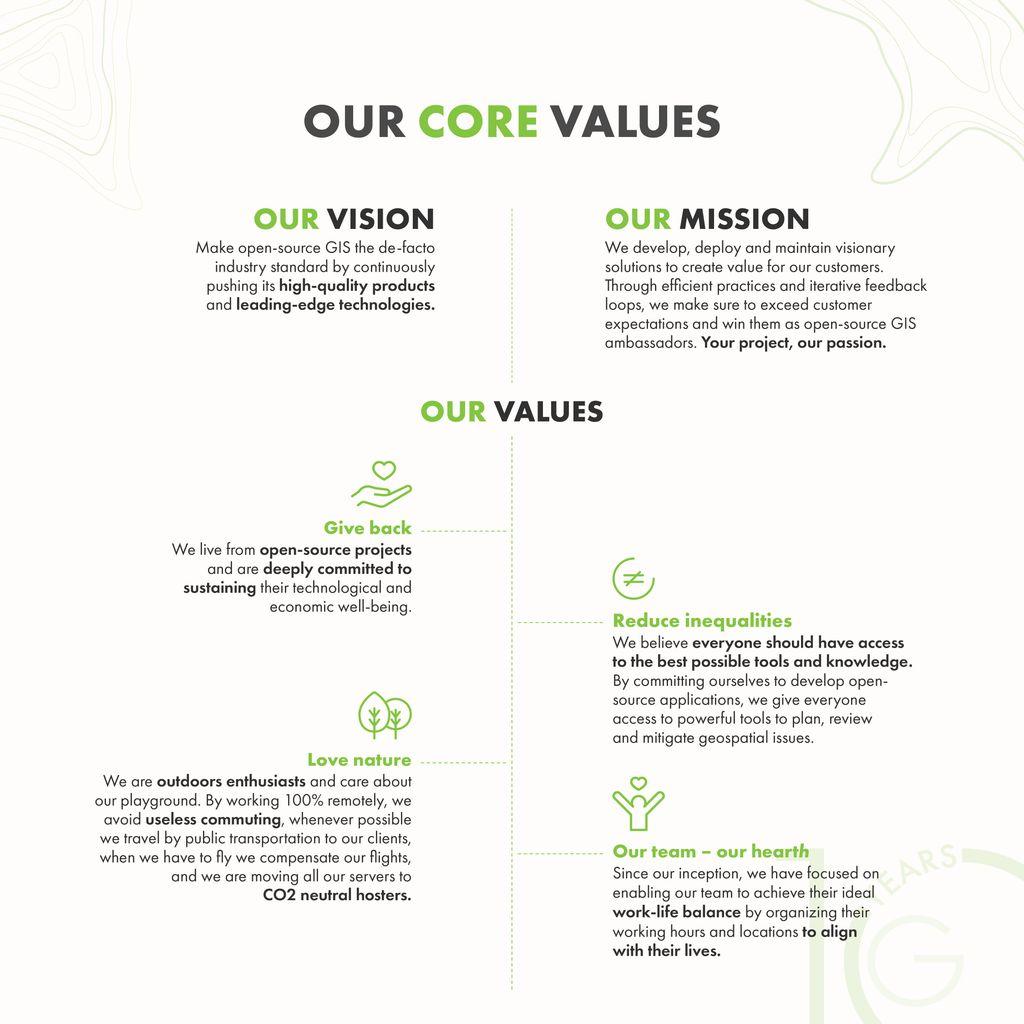
 Give back
 Love nature
 Reduce inequalities
 Our team – our heart[h]
 Crowdfunding pour la gestion des arcs de cercle dans
 Meilleure gestion
 Intersections propres
 Nouveaux cas d'usage


 Nochmals vielen Dank an
  Die Veranstaltung ist hybrid. Die Anmeldung ist gratis und möglich bis am 20. September:
  Ich darf im Rahmen der Veranstaltung mit Adrian Moser, Michael Berteld, Jonas Eckenfels und Christian Michel eine Podiumsdiskussion führen. Vielen Dank für die Einladung!